|
Announcing The NEW MegaSceneryEarth Version 3
Aerial Photography
PhotoScenery At A Whole New Level Of Vivid Color, Clarity and REALISM Than
Ever Before And Updated With The Latest 2014 or 2015 Imagery.
The First Title
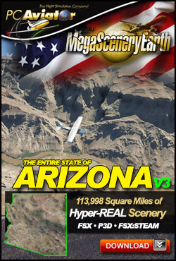
Arizona
114,000 SQUARE MILES
OF SPECTACULAR DESERT TERRAIN
RECREATED FROM NEW 2015 AERIAL IMAGERY!
OUT NOW!
FOR FSX, FSX:STEAM & PREPAR3D
ORDER BY INSTANT DOWNLOAD OR ON DVD.
UPGRADE AVAILABLE FOR OWNERS OF PREVIOUS ARIZONA TITLES
PLEASE KEEP READING FOR MORE INFORMATION AND
ORDERING INFORMATION
That's right, we're pleased to
announce the new version 3.0 of MegaSceneryEarth and with version 3.0,
your flight sim scenery takes on a whole new level of realism with the
latest 2015 aerial data photographed with the latest equipment and
preprocessed for flight sim scenery using inhouse proprietary techniques
to reproduce to near perfection, the color, clarity and sharpness of the
scenery while maintaining the same 1.19 meter resolution so that there is
no additional storage overhead and no degradation of framerate performance
in any way.
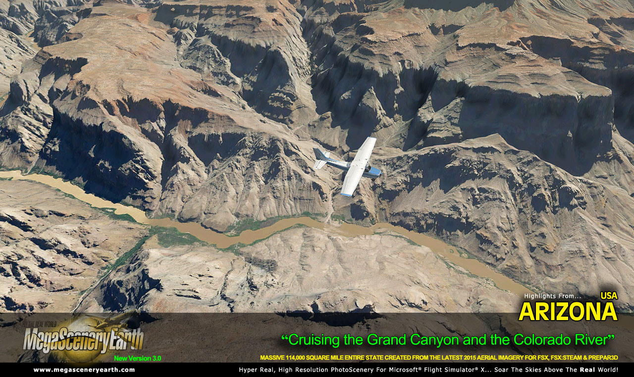
We trust that image above
showcases the amazing clarity and sharpness of the imagery. The real good
news is that previous V2 was really only good for flying at or above 3,000
feet. The new version 3.0 enables you to still view your scenery with
decent clarity even down to around 1,000 feet. Great for approaches and
landings.
As well as the new imagery and
preprocessing techniques, the new version 3 specification also introduces
new accurate topographical information such as inland water bodies and an
accurate (in most cases) hand etched coastline and water blend offering
you a realistic inland and coastal flight sim scenery experience. We've
also introduced other enhancements and fixes and you will be pleased to
know that default night scenery transitions perfectly during dawn and
dusk.
One issue that continues to
plague this line and other photoreal lines is the misalignment of default
FSX non-primary airports. This is not a problem with our scenery but with
the guessed placement of non-primary airports when FSX was originally
created. This wasn't a problem when used with generic scenery but with the
advent of photoscenery where the image of the airport is geographically
correct, this misalignment shows through. The problem does not exist with
primary airports. A primary airport is one that has some kind of
navigational aid. Non primary airports do not have any navigational aids
associated with them and are often small public airports or private
strips. There are tools available to correct these misalignments e.g. ADE
and FSXPlanner and we call on our customers and the flight sim community
who want a better experience to realign those airports and submit them to
us and we will offer them for free to our customers who purchase
respective states. We know this call will result in multiple people
submitting the same airports. Since administrating this could potentially
keep us too busy, we will simply accept the first of each airport
submitted. We will add further information on this to our website in the
coming days. Please wait until we have set that up before you submit any
airport realignments.
With version 3,
we are starting at the beginning again and bringing you the entire USA,
state by state, as quickly as we can and then expanding into other parts
of the word. You can still purchase previous versions and upgrade to
version 3 versions as they become available and of course, anyone owning a
previous version is entitled to a 50% discount upgrade on the respective
version 3.0 title.
We did recently
announce a 4X series however this did have a number of drawbacks that
prevented us from continuing this series, namely the lack of available
quality imagery and the higher resolution plus production turned out to be
a massive effort that was not able to achieve sustainable returns plus
there was additional disk space needed by you and 4 times more needed by
us in the production. As a result we concentrated our efforts on improving
the slightly lower resolution 1.19 meter product and achieved a result
better than the 4x product and with less overhead for everyone.
We are
extremely proud of our first title, Arizona. We bring you this massive
114,000 square mile state with the latest 2015 imagery and preprocessed to
near perfection. Please go ahead and visit the webpage and take a look at
the imagery you will be soon flying over. We are all very fortunate in
that this title brings us all the most wanted landmark to fly over and
that is the Grand Canyon. This title gives you the entire Grand Canyon to
fly over, and in and amongst, at a level of detail that has never been
recreated before for a flight simulation scenery product.
As far as
pricing, we are pleased to be able to keep the same pricing structure as
before with most states $29.95 and $39.95 with the smaller states at
$19.95 and the super sized states (TX & CA) being offered in multiple
areas. All titles can be installed with Microsoft Flight Simulator X,
FSX:STEAM and PREPAR3D V1, 2 & 3.
Our production
machines are running 24/7 and we will endeavor to bring these titles out
at as quickly as we can. Fans of MegaSceneryEarth now have something to
look forward to again with one to 2 weeks between releases. We'll also be
putting up a schedule of anticipated releases at the MegaSceneryEarth
website soon so you can look forward to your home state.
We trust you
enjoy the new version 3 of MegaSceneryEarth and that it fulfils all your
needs for the ultimate in flight sim scenery realism.
Now, here's the
blurb on Arizona. Please go ahead and order and enjoy. If you owned a
previous version of an Arizona title, please check your e-mail for an
upgrade code to enjoy a 50% discount.
MegaSceneryEarth V3
Arizona
Instant Download. Be flying
within the hour!
Created From The Latest
2015
Aerial Imagery
Price: Just $39.95
Out Now!
Price: $39.95 Media:
Instant Download/DVD
Compatibility: FSX/FSX:SE/P3DV1.X/P3DV2.X/P3DV3.X
Download Size: 46,700 Mb,
Area: About 114,000 square miles
Download Time (50, 20, 10, 5 Mbps): 2 Hrs, 4.5 Hrs, 9 Hrs,
18 Hrs
CLICK HERE FOR MORE INFORMATION OR TO ORDER
|